
Observation-only trips give a beginner a low-consequence way to learn how much a real landscape refuses to fit into a neat plan. Light changes. Vegetation hides landmarks. Other visitors appear. Gates close. Weather moves faster than expected. Wildlife may not appear at all, or a distant animal may not be identifiable with confidence.
That uncertainty is useful. The objective is not to find a future target. It is to practice permission, boundaries, wildlife distance, map orientation, communication, weather awareness, accessibility, and a timely return without carrying a weapon or creating pressure to harvest.
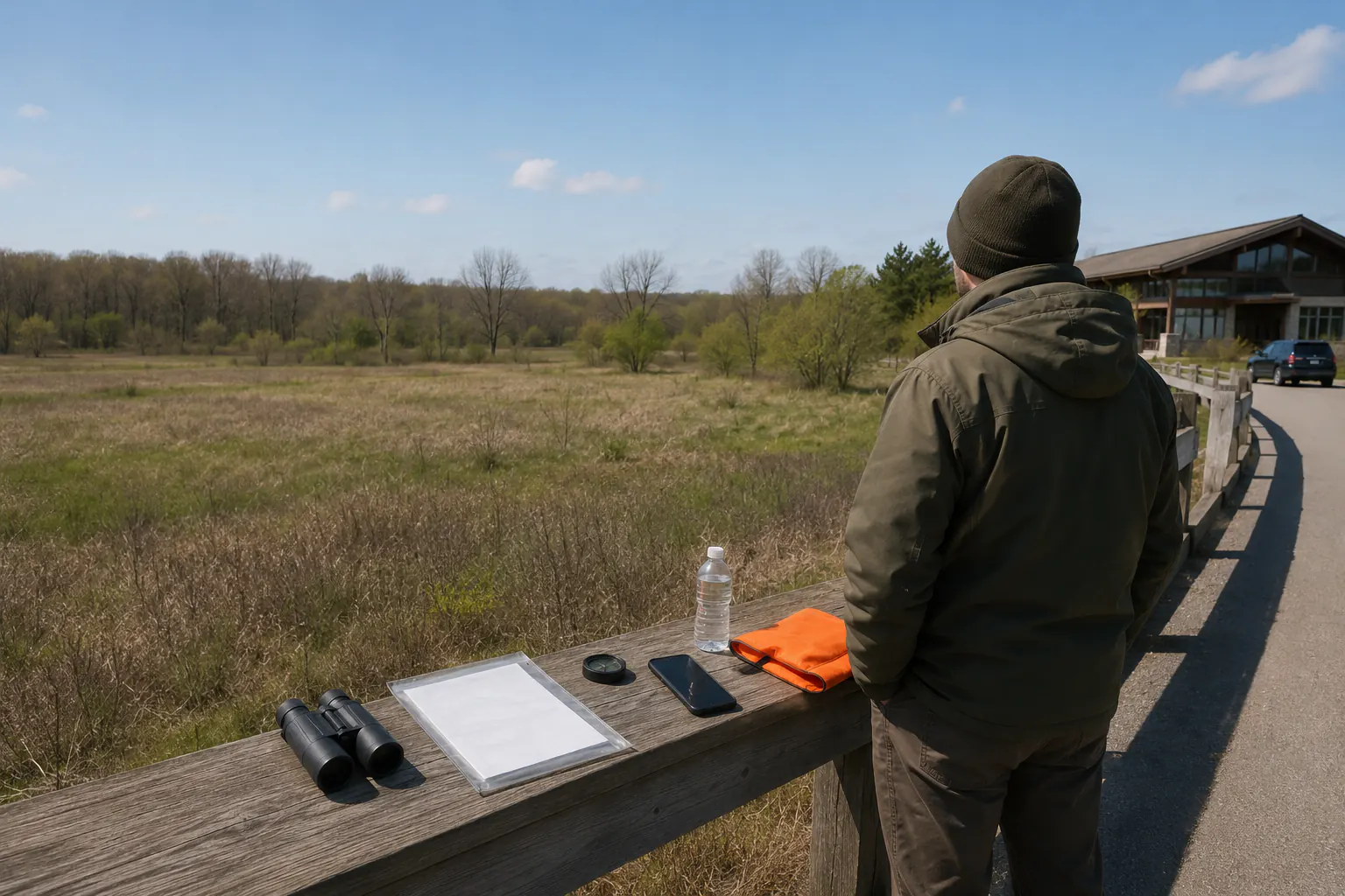
Choose an observation setting
Start with a lawful wildlife-viewing area, agency education event, maintained trail, refuge visitor area, or private property where the owner has explicitly permitted the planned activity. Confirm the exact site rules. A place that allows ordinary visitation may restrict hours, parking, off-trail movement, dogs, food, calls, blinds, photography, group size, collecting, night access, or hunting-related activity.
For a first session, prefer:
- daylight and mild, stable weather;
- a maintained route with clear access and a short return;
- a substantial building or hard-topped vehicle available as the weather plan where appropriate;
- reliable phone or radio coverage plus an offline map;
- a clear meeting point and check-in contact;
- no water crossing, scrambling, steep exposure, remote overnight travel, or technical terrain;
- a session short enough for medication, food, hydration, temperature, mobility, child, animal, and caregiver needs.
Do not select a site because a social post reported an animal there. Do not trespass or crowd a roadside, shoulder, driveway, field entrance, emergency access, or another visitor’s location.
Define the non-hunting scope
Write the session objective in one sentence, such as: “Orient the official map at the visitor-area trailhead, identify three fixed landmarks, practice two check-ins, observe wildlife only from the maintained route, and return by 3 p.m.”
The session excludes:
- weapons, ammunition, bows, arrows, traps, or restricted equipment;
- pursuit, stalking, flushing, driving, baiting, calling, scent use, spotlighting, or drone use;
- approaching nests, dens, young animals, feeding areas, or a carcass;
- touching, collecting, feeding, treating, rescuing, or moving wildlife;
- entering a closed, private, hazardous, or unclear area;
- testing camouflage or concealment against people;
- claiming legal species, sex, age, health, or harvest identification from a photo or app.
If the site defines ordinary wildlife viewing more narrowly, its rule controls.
Build the trip card
Record this before departure:
| Field | Entry |
|---|---|
| Site and land manager | Exact official name and contact channel |
| Permission and rules checked | Source title, revision, and access date |
| Route | Start, turnaround, meeting point, and prohibited boundaries |
| Time | Arrival, check-ins, turnaround, and overdue trigger |
| Weather | Forecast source, watch/warning channels, and leave triggers |
| Group | Names, roles, medical/access needs, and emergency contact |
| Communication | Primary, backup, coverage limitation, and lost-contact action |
| Observation goal | One low-consequence skill and what counts as complete |
| Stop rules | Conditions that end the session immediately |
Share the trip plan with a person who is not on the outing. Tell that contact what to do and whom to call when the overdue trigger is reached. A vague “we should be back sometime” is not a check-in plan.
The family emergency communication plan owns contacts and meeting places. The multi-channel alert guide helps avoid depending on one signal path.
Assign visible roles
For a small group, name:
- trip lead, who owns the route and turnaround;
- boundary observer, who compares the official map, signs, and landmarks;
- weather and time observer, who watches alerts, sky, temperature, and deadlines;
- communication and access lead, who keeps check-ins, medication, mobility support, and return needs visible;
- wildlife recorder, who notes only what can be observed without changing behavior or distance.
One adult may hold several roles. A child can count landmarks or announce a scheduled check-in while an adult retains all safety and wildlife decisions. Nobody is required to move closer, remain quiet beyond comfort, tolerate cold or heat, or continue after asking to stop.
Observe without over-identifying
Use current agency field materials for the location and likely species, but preserve uncertainty. Record broad observable characteristics: approximate size, color pattern, movement, habitat, time, distance, and viewing conditions. Write “unconfirmed” when distance, light, cover, angle, or knowledge prevents a reliable identification.
Binoculars or a camera do not turn an uncertain observation into legal identification. Image recognition, a search result, tracks, scat, calls, antlers, feathers, or a partial view can be misleading. A qualified instructor and the responsible wildlife agency own species education and legal distinctions.
If an animal is sick, injured, acting abnormally, found dead, entangled, aggressive, unusually close, or creating a road hazard, increase distance and contact the site or wildlife authority. Do not handle it or improvise care. CDC advises keeping distance from wildlife and notes that hunters can face disease exposure from animals and tissues.
Practice route discipline
At the start, orient the current official map and identify the route, return direction, fixed landmarks, boundaries, and no-entry areas. The map and compass guide teaches familiar-location practice, but a compass does not reveal land ownership, current closure, safe terrain, or legal access.
Use simple decision points:
- At each junction, identify the return route before proceeding.
- At every boundary sign, compare the official map and stop if they conflict.
- At the halfway time, turn around even if the observation goal is incomplete.
- At loss of orientation, stop movement, protect the group, and use the trip plan rather than wandering to recover a guess.
- At lost communication, follow the predetermined return or emergency action.
Do not separate the group to cover more area. Do not leave the lawful route to get a clearer image. A successful session can include seeing no wildlife.
Use weather and visibility gates
Check current forecasts and alerts before leaving and during the session. End early for thunder, lightning risk, severe-weather watches or warnings that affect the route, smoke, fire notice, rising water, rapidly falling visibility, unsafe heat or cold, strong wind around trees, ice, or any condition outside the written plan.
Ordinary outdoor clothing and a small rain layer do not make severe conditions acceptable. The emergency shelter principles guide explains why a tarp or open shelter is not a lightning, tornado, wildfire, flood, falling-tree, or extreme-temperature refuge.
Visibility includes being seen by other people. Follow current site and season instructions for high-visibility clothing, especially where hunting activity may lawfully occur. Do not assume a quiet trail or observation area excludes every other use.
Debrief observable facts
Immediately afterward, record:
- actual start, turnaround, and return times;
- route changes and why they occurred;
- check-ins completed or missed;
- forecast versus observed weather;
- fixed landmarks that were easy or difficult to use;
- boundary or sign questions for the land manager;
- wildlife observations, including every uncertainty;
- clothing, hydration, mobility, medication, communication, and visibility friction;
- any rule or instruction that needs current authority clarification;
- one change before the next trip.
Do not score the outing by animals seen, distance traveled, photographs taken, or time spent outside. Score nothing. The valuable outcome is a specific correction.
Progress conservatively
Repeat the same maintained route under similarly benign conditions before adding complexity. A next step might be another observation time, a qualified naturalist event, an agency beginner workshop, or a supervised mentor session. It should not automatically be a live hunt.
The hunter education guide and state rule file remain independent gates. Observation does not replace them, and course completion does not erase route or identification uncertainty.
Return to the Hunting for Food hub with the trip card and debrief. Responsible planning begins by proving that the group can stop, return, and leave wildlife undisturbed when nothing goes according to expectation.